Find What Fits Your Toyota


Garmin Tread - Overland Edition
Garmin Tread - Overland Edition

Universal Fitment
- Built for every part of the journey, this rugged all-terrain navigator has the mapping you need to stay on track and communication technology to stay in touch while you’re out there.
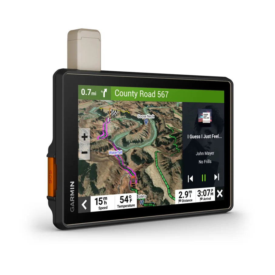
- Reliable Navigation – Turn-by-turn guidance on unpaved roads with OSM and USFS maps.
- Durable & Connected – IP67 design, 8” bright display, and inReach® satellite communication.
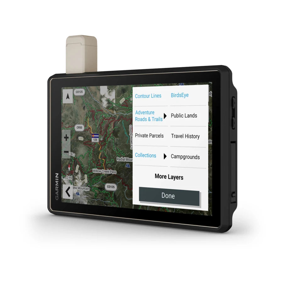
- Smart Mapping – Download BirdsEye imagery, custom route by vehicle size, and sync with Tread®.
Couldn't load pickup availability


Fast US Standard Shipping &
Easy International Shipping
30-Day Returns
TG Pro
Satisfaction Promise
Trail Grid Pro Tested
- Details
Don't Arrive At Your Destination. Discover It.
Available in 8" or 10" Screen Sizes.
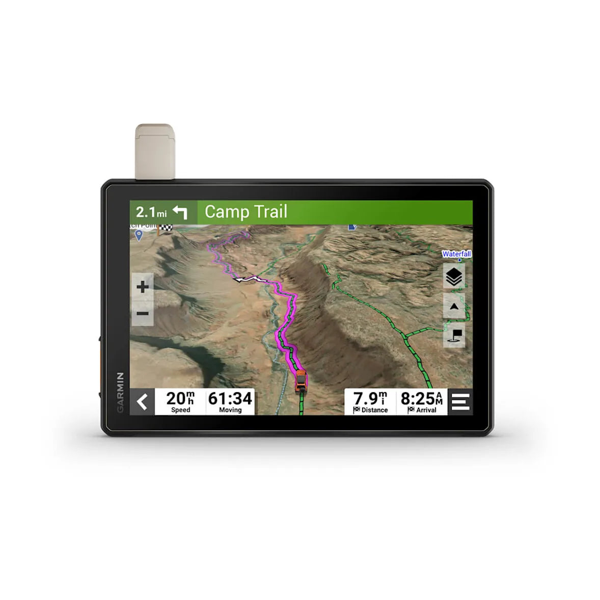
This rugged all-terrain navigator is built for every adventure, offering essential mapping tools and communication technology to keep you on track and connected. It features turn-by-turn trail navigation with OpenStreetMap (OSM) and USFS Motor Vehicle Use Maps, along with custom routing based on your vehicle’s size and weight.
Preloaded iOverlander™ POIs help you find campsites, while its IP67 weather-resistant design and 8” ultrabright touchscreen ensure durability and clear visibility. Enhance your journey with downloadable, subscription-free BirdsEye Direct Satellite Imagery, sync routes across devices using the Tread® app, and stay connected globally with inReach® satellite communication (subscription required).
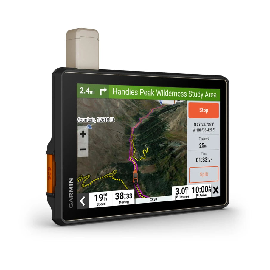
- Navigate unpaved roads and trails by using turn-by-turn trail navigation1 with OpenStreetMap (OSM) and USFS Motor Vehicle Use Maps.
- Custom routing for the size and weight of your rig2 and preloaded iOverlander™ points of interest (POIs) help you find where to set up camp.
- This rugged navigator is IP67 weather-resistant and has an 8” ultrabright touchscreen display.
- See vivid aerial views of terrain with downloadable, subscription-free BirdsEye Direct Satellite Imagery.
- Use the Tread® app on your compatible smartphone to sync data across your various devices and plan routes.
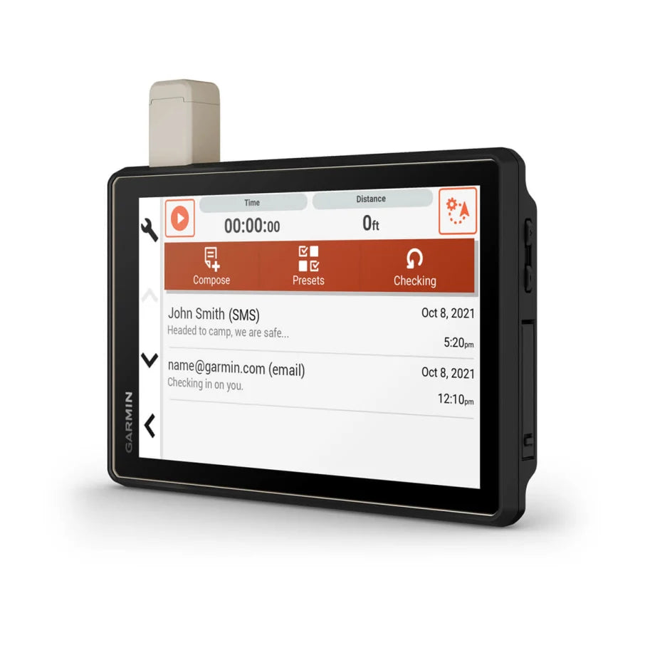
- Peace of mind comes built-in. With an active subscription, you can use inReach® technology for global satellite communication.
OFF-ROAD RUGGEDNESS
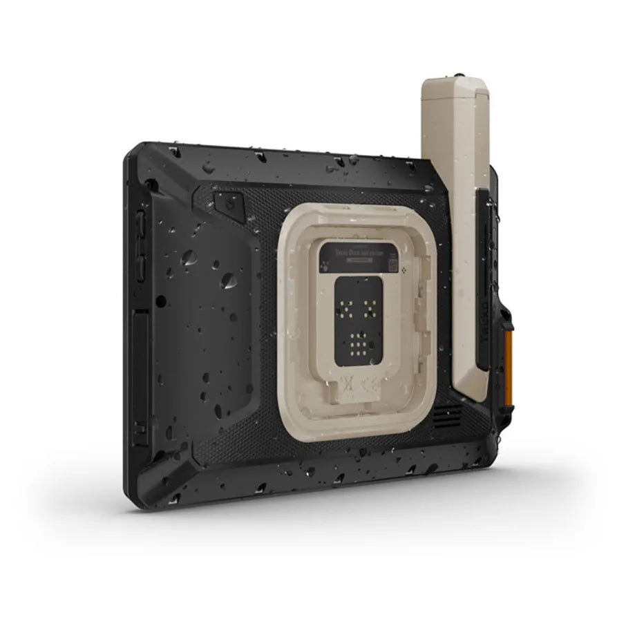
Purpose-built for all-terrain use, this Tread device stands up to anything the elements can throw at it. It’s IP67-rated for water-resistance.

HIGH-VISIBILITY DISPLAY
With its ultrabright 8” glove-friendly touchscreen, the navigator is designed for easy viewing in bright sunlight or pitch dark. It can be mounted in portrait or landscape mode.

TRAIL NAVIGATION
Enjoy turn-by-turn trail navigation for traversing unpaved roads and trails using adventure roads and trails map content comprised of OSM and USFS Motor Vehicle Use Maps.

BUILT-IN INREACH TECHNOLOGY
Built-in inReach technology offers global satellite communication3, two-way text messaging, location sharing and interactive SOS (active satellite subscription required).

MAPS ON AND OFF-ROAD
Tread includes preloaded topographic maps with 3D terrain for North and South America. It also includes detailed street maps of North America with custom routing for the size and weight of your rig2.

KNOW YOUR BOUNDARIES
Access U.S. public land boundaries for national forests, Bureau of Land Management (BLM), wilderness areas and more. Also, see U.S. private land boundaries and landowner information for parcels greater than 4 acres.

SATELLITE IMAGERY
Enjoy vivid aerial views when you download high-resolution BirdsEye Direct Satellite Imagery directly to your device via Wi-Fi® connectivity, with no annual subscription required.

TRAIL RATINGS
Our growing trail database now includes difficulty ratings for off-road riding areas, where available, across the U.S.

SNOWMOBILE TRAILS
View snowmobile trail content for select areas within the U.S. and in Canadian provinces. This includes snowmobile-accessible locations such as fuel stops, warming shelters, restaurants and more.
OUTDOOR MAPS+
With a paid Outdoor Maps+ subscription, you’ll get ongoing access to a wide variety of additional premium map content. It is regularly updated and delivered directly to your Tread device via Wi-Fi® connectivity.

POINTS OF INTEREST
Tread comes preloaded with iOverlander points of interest and Ultimate Public Campgrounds, so you don’t need a cell signal to route to the best-established, wild and dispersed campsites.

ABC SENSORS
When you’re headed to tough-terrain, the built-in sensors will come in handy — including an altimeter, barometer, compass and pitch/roll gauges.
